Reducing Damage to Underground Utility Infrastructure During Excavation
Costs, benefits, technical advances, case studies, and recommendations
by Geoff Zeiss and Dr. Sakura Shinoaki
Abstract
Every year there are injuries and fatalities attributable to hitting underground infrastructure during excavations. It has been estimated that unreliable location information about underground 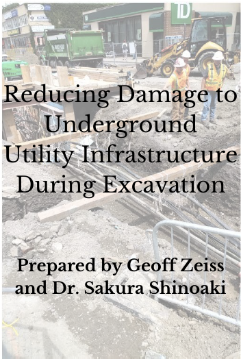 infrastructure represents a $50 billion to $100 billion drag on the U.S. economy, multiple £ billions in the U.K. and € 1 billion in the Netherlands. Comparing the United States and Japan reveals a startling difference in the number of incidents of underground utility damage during construction. In the U.S. the number of incidents is between 400,000 and 800,000 per year (roughly one or two every minute). For Japan the number of incidents in 2016 was 134. Clearly something can be done to reduce the risk for construction workers and the public and the economic impact. infrastructure represents a $50 billion to $100 billion drag on the U.S. economy, multiple £ billions in the U.K. and € 1 billion in the Netherlands. Comparing the United States and Japan reveals a startling difference in the number of incidents of underground utility damage during construction. In the U.S. the number of incidents is between 400,000 and 800,000 per year (roughly one or two every minute). For Japan the number of incidents in 2016 was 134. Clearly something can be done to reduce the risk for construction workers and the public and the economic impact.
Many jurisdictions in the Americas, Europe, and Asia Pacific have implemented policies and organizational structures for sharing information about the location of underground infrastructure. These include comprehensive programs involving many different stakeholders, government mandated and run, government mandated and industry financed and run, industry supported and privately run, and municipally mandated and run. Statistics reveal that a comprehensive approach involving policies, technologies and construction practices is required to be successful in developing a program for continuing improvement in reducing utility damage during construction. Based on a review of international initiatives for improving location information about underground infrastructure, a set of 25 recommended elements have been compiled that should be considered by jurisdictions intending to develop such a program.
How to Download
This white paper, prepared for the Geospatial Information and Technology Association by Geoff Zeiss and Dr. Sakura Shinoaki, is available FREE to download. Please take the time to fill out the short order form below to download.
NOTE: By downloading this white paper and creating a free (non-member) GITA account, you are consenting to email communication from our association. You may unsubscribe to these emails by following the unsubscribe steps at the bottom of each GITA email.

Authors
Geoff Zeiss
Geoff tracks the contribution of geospatial technology to the digitalization of the construction and energy industries on his Between The Poles blog and other media. His area of special focus is locating, mapping, and sharing information about underground utility infrastructure.
For ten years, Geoff was responsible for though leadership, evangelization, and industry messaging for the utility industry program at Autodesk. In recognition of his efforts to increase the awareness of geospatial data and technologies in utilities and construction, Geoff received the Geospatial Ambassador Award at Geospatial World Forum 2014 in Geneva, Switzerland.
He is a member of the National Underground Asset Registry Advisory Group of the Geospatial Commission, Cabinet Office, in the U.K. He contributed to the founding of the Open Source Geospatial Foundation in 2005/2006. He actively supports open standards as a director of the Open Geospatial Consortium.
Dr. Sakura Shinoaki, Dr. Eng., Professor Emeritus, Otsuma Women’s University; President, GITA-Japan
Shinoaki graduated from Tokyo University, Dep. of Mathematical Engineering & Information Physics in 1967. He received the  doctor degree of engineering for his study of Geospatial Information System from the University of Tokyo in 1993. In Tokyo Gas , the largest Gas company in Japan, he developed TUMSY (Total Utility Mapping System), a versatile GIS engine in 1983 and from 1984 to 1990, digitized 30,000 drawings of gas mains, services and topography. He also built GIS database ,linked to 8 million Customer Information DB and developed various applications from network analysis to gas marketing. doctor degree of engineering for his study of Geospatial Information System from the University of Tokyo in 1993. In Tokyo Gas , the largest Gas company in Japan, he developed TUMSY (Total Utility Mapping System), a versatile GIS engine in 1983 and from 1984 to 1990, digitized 30,000 drawings of gas mains, services and topography. He also built GIS database ,linked to 8 million Customer Information DB and developed various applications from network analysis to gas marketing.
From 1986 to 1996, as the main member of the development committee of Ministry of Construction, he played a major role to develop a National GIS system ,called ROADIS (Road Administration & Information System) based upon TUMSY. It built up huge GIS database of road, water, sewage, electricity, telecommunication, gas, subway, in other words, city total infrastructures in 12 major cities of Japan including Tokyo. After being invited to the first AM/FM International Conference in Denver USA by Hank Emery, in August,1982, Shinoaki has founded AM/FM International JAPAN in 1990.and has promoted information sharing , international exchange and education.in the area of GIS.
Since 2002 he has been a president of GITA-JAPAN. From 2001 to 2015, he was a professor of Otsuma Women’s University Dep. of Social Information and educated GIS to many students and engineers. He has been a member of domestic committee and international expert of ISO/TC211 from 1998 to 2015 and contributed to the standardization of GIS.
In 1985. he received Niwa Prize from Japan Information Center of Science & Technology for “Hierarchical database system for Geographical information “. He also received Ishikawa Prize from Japan Science and Technology Federation for “Development of computerized Mapping system in Tokyo Gas”, in 1985 and “Mobile Mapping System in Emergency” in 1993. He received “GITA Lifetime Achievement Award’” from GITA North America in recognition of his contribution to GIS and GITA International in 2005.
|